Slick spots for interior areas through the morning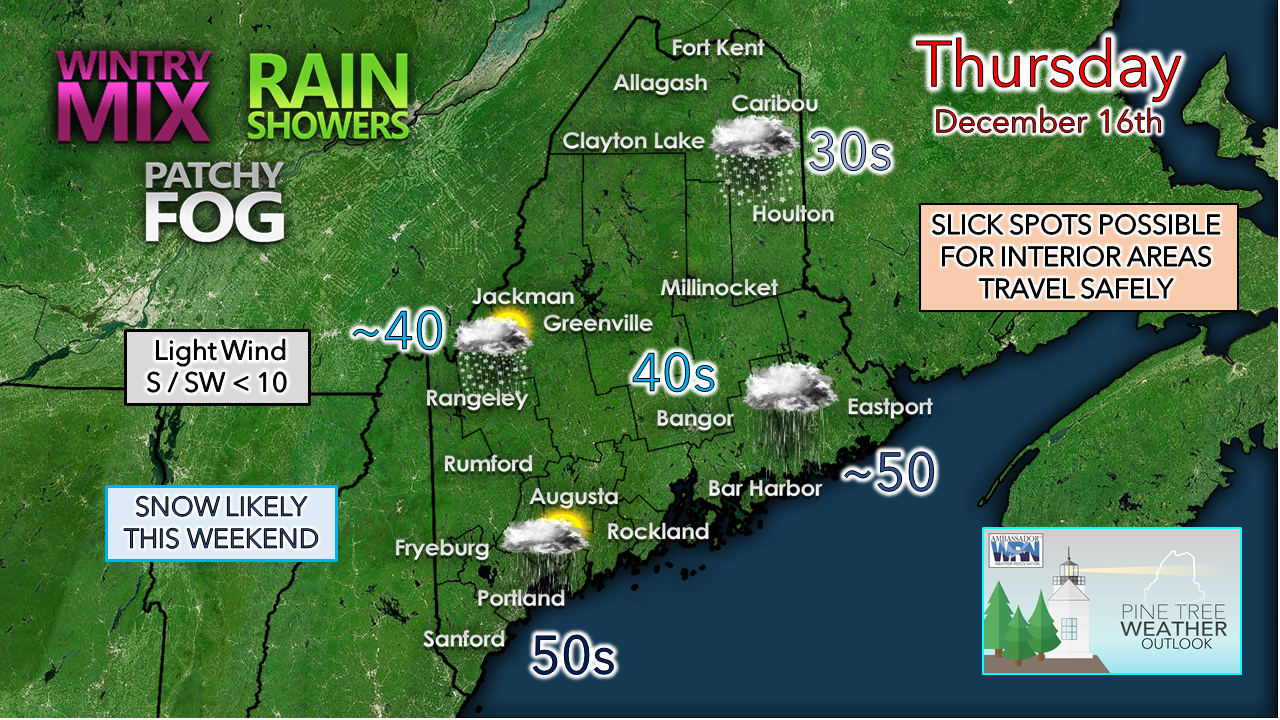 Precipitation is falling in several types across the region to start off. A warm front over southern New Hampshire moves northeast during the day. Cold air damming is doing its thing over the interior and is likely to be an issue through the morning, keeping the potential for pockets of freezing rain and freezing drizzle going there. Areas of fog are possible during the day and into Thursday night. Southern and western areas may see the sun pop out this afternoon, and if it does, temperatures will rise well into the 40s and 50s. A cold front sweeps through the region overnight and the wind picks up heading into Friday. 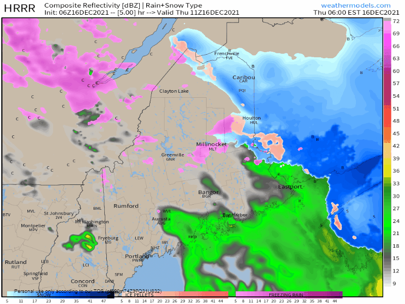 Thursday 6 AM to 6 PM - As the warm front lifts to the northeast, another wave of precipitation passes through the region and pending upon temperatures will dictate what happens once it reaches the surface over interior areas. A lull in steady rainfall is likely this afternoon, but in that absence is the potential for areas of fog and patchy drizzle over the interior. The best chance for the sun to peek out over southwestern areas appears likely to come in the afternoon. The mountains and north may get a rain shower toward evening as the cold front approaches from the northwest. 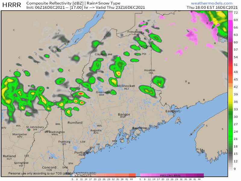 Thursday 6 PM to Friday 6 AM - The cold front passes through the region overnight, with northern areas seeing the best chance for rain showers. Cold air moves in aloft and brings the chance for snow showers and squalls over the western mountains by daylight Friday. Daily high temperatures peak around midnight for the mountains and north and fall during the day. Cold air advection from the wind keeps the coastal plain warmer. Breezy conditions for Friday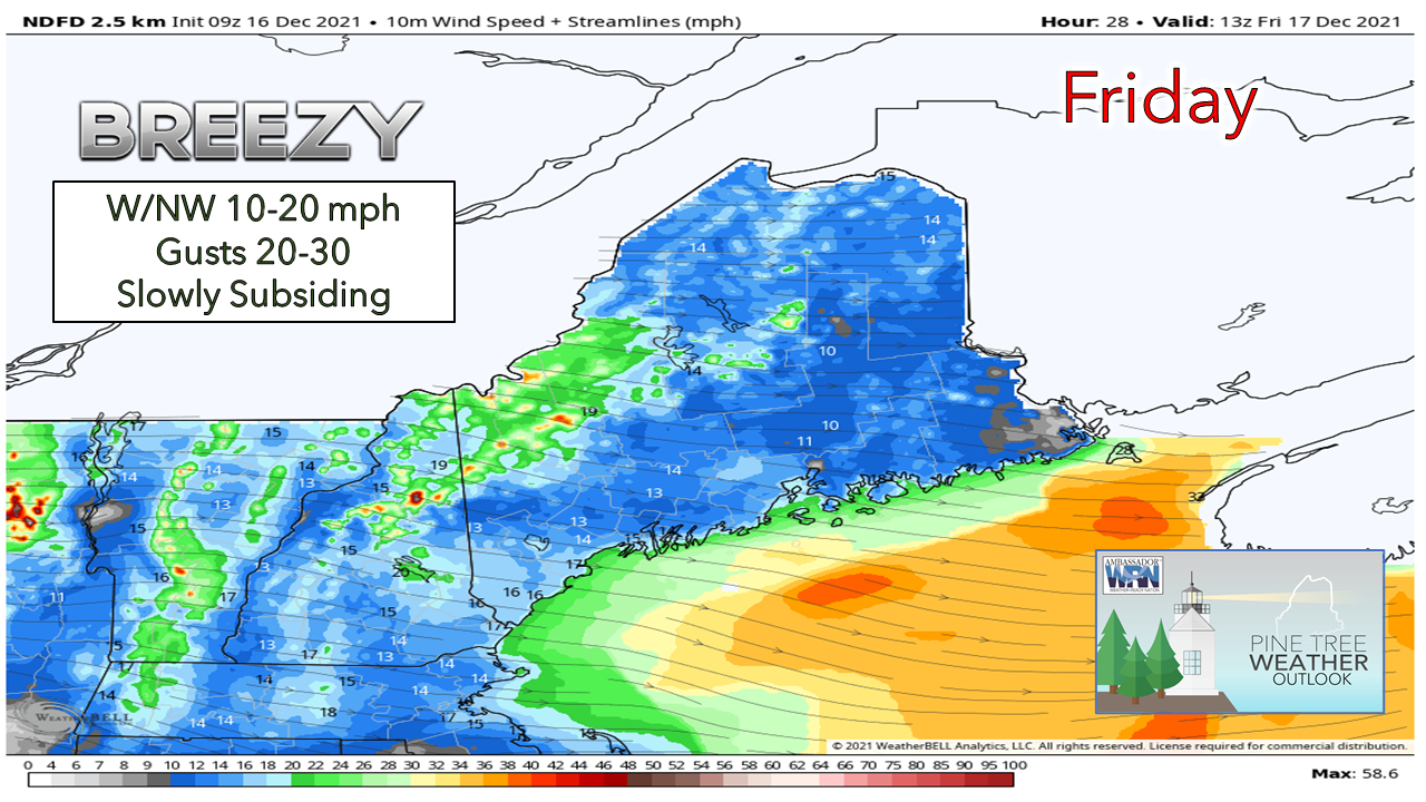 The wind speeds are likely to be strongest in the morning on the heels of the passing front. The mountains and valleys may see gusts reach 30-40+ mph in the wee hours of Friday, and then slack somewhat heading into the daylight hours. The stiff breeze gradually drops in the afternoon and into Friday night as high pressure moves in. Snow likely for the weekend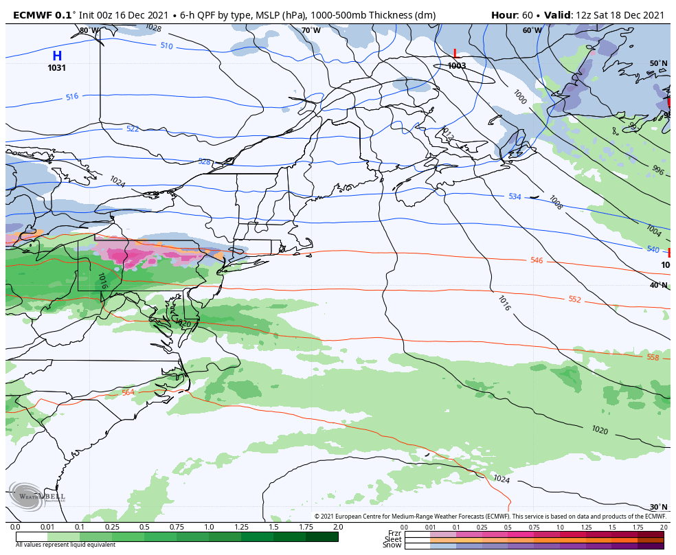 Saturday 7 AM to Monday 7 AM - It appears at this point that snow holds off until the afternoon for southern and western areas before overspreading the region Saturday night. Low pressure passing through the region along a stalled frontal boundary appears to remain south just enough for this to be a mainly snow event for the coast. An inverted trough set up may allow snow to fall over the entire region heading into Sunday. Conditions appear to improve Sunday afternoon into Sunday night as steady snow tapers to snow showers and end for all but the high peaks and the north heading into Monday. 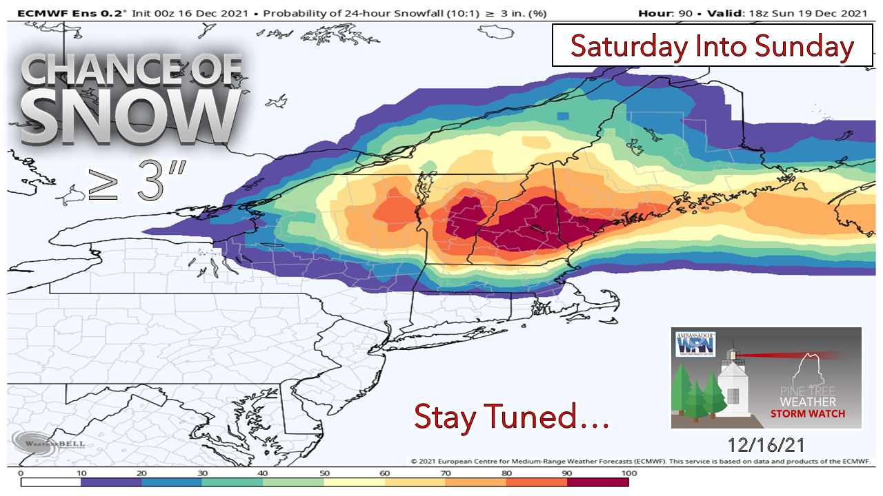 Ensemble ideas continue to gain confidence for a solid snow event for southwestern areas. A rough idea on accumulation appears to be 3-6" from Rangeley to Belfast south, and 1-3" to the north and east. There is still some inconsistency in ideas, namely the influence of the inverted trough which will be key for snow amounts interior areas. Stay tuned for updates.   Freezing Drizzle When surface temperatures are below freezing, drizzle will form a thin layer of ice on the roads. This difficult-to-see ice can cause dangerous travel conditions. When it’s drizzling in the winter, slow down, don’t use cruise control, and keep your distance from other vehicles. Don’t let freezing drizzle sneak up on you! Be prepared to receive alerts and stay updated!
 For more information in between posts, please follow Pine Tree Weather on Facebook and Twitter.
Thank you for supporting this community-based weather information source which operates by reader supported financial contributions. - Mike |

Mike Haggett
|