
Summer, right on timeThis past weekend gave an indication of how the week ahead would unfold. A similar scenario of a pinwheel effect of an upper level low over eastern Canada will send repeated short waves through the region. The result of that are daily chances for showers and thunderstorms starting Tuesday and continuing through the remainder of the week and possibly into the last full weekend of June.  Monday will be the last dry day, both in lack of precipitation and humidity levels. A frontal boundary approaches from the west on Tuesday, which will push humidity levels upward. As the shortwaves rotate through the region, humidity will rise ahead of them, then fluctuate, then repeat itself. Included in the humidity comes potential energy for thunderstorms, especially for the mountains, central highlands and areas along the Quebec border. 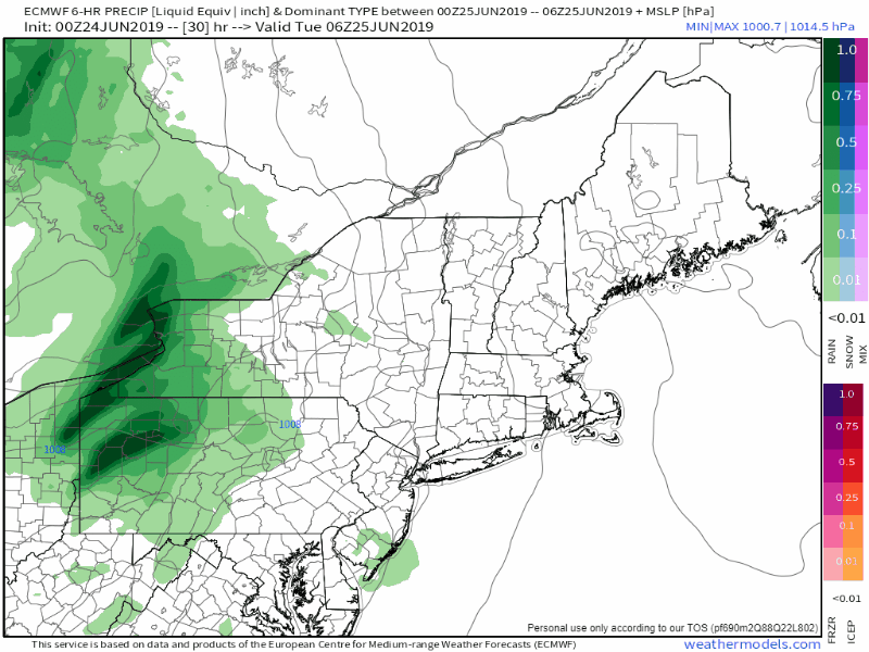 The pinwheel effect appears likely to continue through the week and potentially into next weekend. The Quebec border region is likely to see the better chance for rain. Southern and eastern areas will depend on the day. Tuesday, Thursday and Saturday appear to be the best chances for showers and thunderstorms for the coastal plain, but with the uptick of humidity and seabreeze influence, I can't rule out potential for isolated thunder for Wednesday and Friday. Rain forecast through the week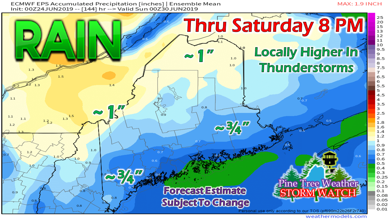 Understand that this is a running total and will slowly accumulate over the next five days. Amounts could vary higher or lower pending on position of the upper low and how juicy the shortwaves get from southwesterly flow. Any thunderstorms could bring downpours which could make amounts locally higher. For those camping this week, it would be in your best interest to consider fast rising brooks, streams and run off in case of thunderstorms. Make sure you have a NOAA Weather Radio handy to check in on the forecasts, and that it is properly set to receive bulletins when necessary. Regional outlook through Saturday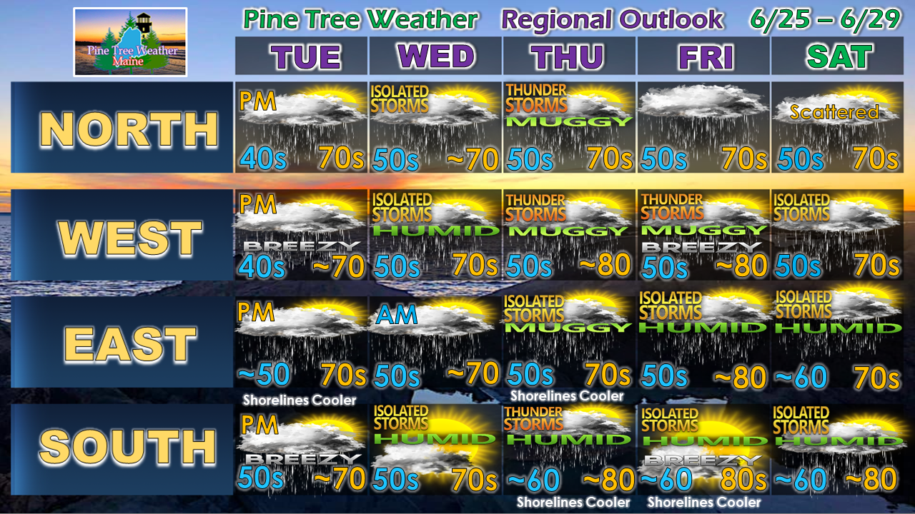 With the rise in dew points along the coastal plain, early morning fog is possibility through the week, which may reduce visibility for the early bird travellers.
Also keep in mind the ocean and northern lakes temperatures are still chilly in the 50s, southern lakes are barely over 60º. It may be refreshing at first, but there is a risk for hypothermia with extended time in the water. The long term trend appears warmer than normal, with above average rainfall as we head into July. The combination of the two means muggy and humid conditions. Are your air conditioners ready to get a workout? It may be time to install and test them before the hazy, hot and humid weather arrives. July is almost here! ► ► For the latest official forecasts, bulletins and advisories, please check in with the National Weather Service in Gray for western and southern areas, or Caribou for northern and eastern parts of Maine. Please consider supporting Pine Tree Weather ► ► Your financial donations are much appreciated to keep this site funded and for further development. I sincerely appreciate your support not only financially, but also in sharing my efforts with others. For more information from me, please check the Pine Tree Weather Facebook page as well as my Twitter feed. Always stay weather aware! - Mike |

Mike Haggett
|


