A tough day to get around the coast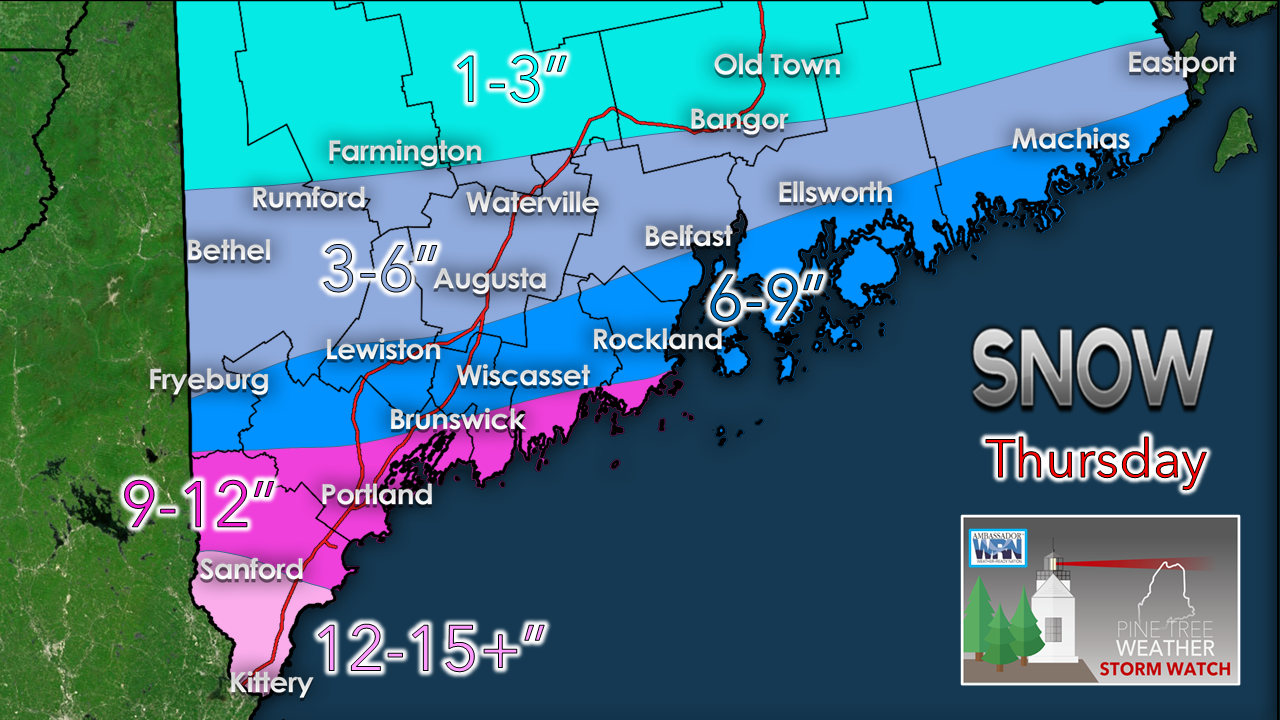 It's a squeeze play between an arctic high and low pressure to the south. For the western mountains and foothills over across central and interior eastern areas, bust potential remains high. For Bangor, I've seen ideas range from flurries to 6". The cut off remains very sharp. For areas from Fryeburg to Eastport south along the coast, confidence in a 6" or more event improves. This is a classic York County Special where the higher end totals will be recorded. 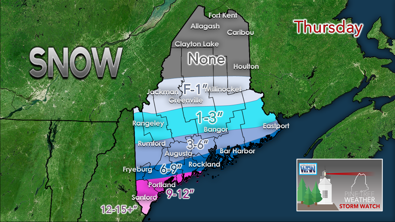 Northern areas take the day off. Jackman, Greenville and Millinocket may see some flakes, and perhaps not much more than that. Think low end for northern areas, think higher end for southern areas. Banding of snow is going to be key. Some areas where I predicted 6" or more may only get couple inches pending on the strength, location and velocity of the bands where they set up. As I mentioned on Facebook Wednesday afternoon, this is going to be miserable event to measure snow for coastal areas given the wind. This storm may not be measured by the snow on the ground, but by the feet of the drifts. TimingTiming remains on track for snow to overspread the southern half of the state through the morning into the early afternoon. Snow ends west and south by late afternoon, by early evening over eastern areas.  Blowing snow into Friday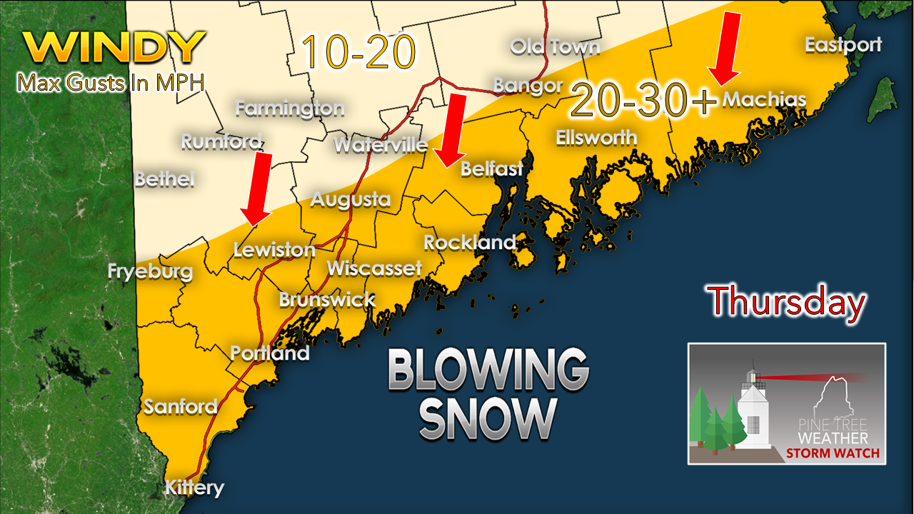 Since we are dealing with power snow, it will blow around as it falls Thursday. As the storm moves east, the wind shifts and continues at 10-20 mph through Friday, settling by evening. With the blowing snow comes reduced visibility. In the heavier snow bands, viewing distance could be measured in feet. Whiteout conditions will be prevalent during the accumulating period. It won't be a blizzard as the predicted wind speed is below criteria, but it may appear like it. You may have to move snow more than you would prefer with this one given the wind. 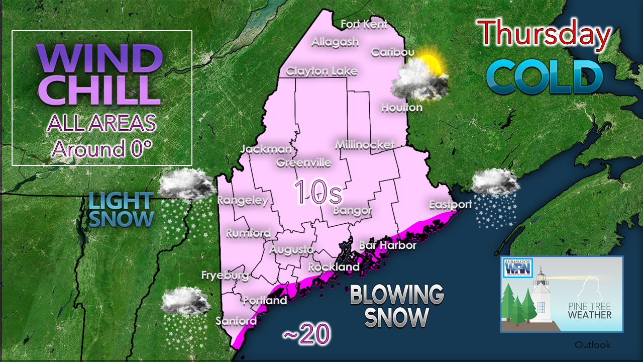 The temperatures indicate the dry air and powder snow. Coastal front is not a concern here. Bundle up if you head out. If you are driving in the coastal region, allow for plenty of time to reach your destination and take is SLOW. Snow total reports appreciated!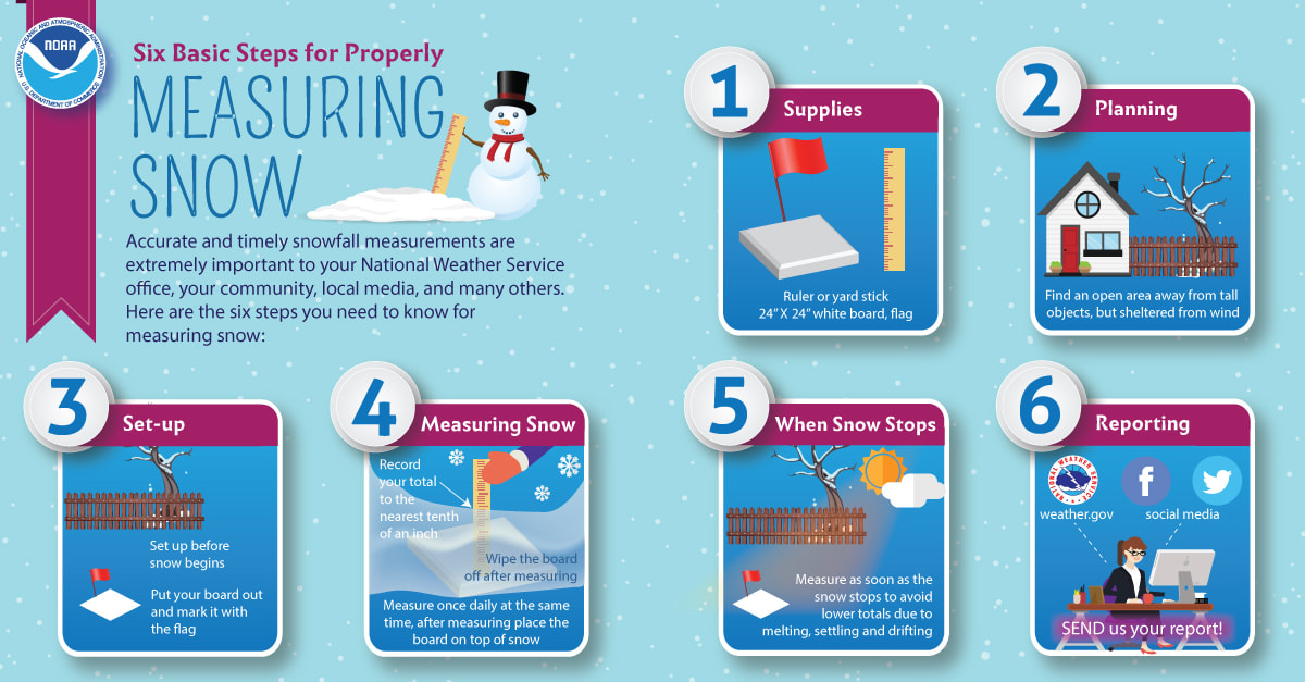 No matter where you are, let me know what you are seeing! Photos are appreciated also. Winter driving safety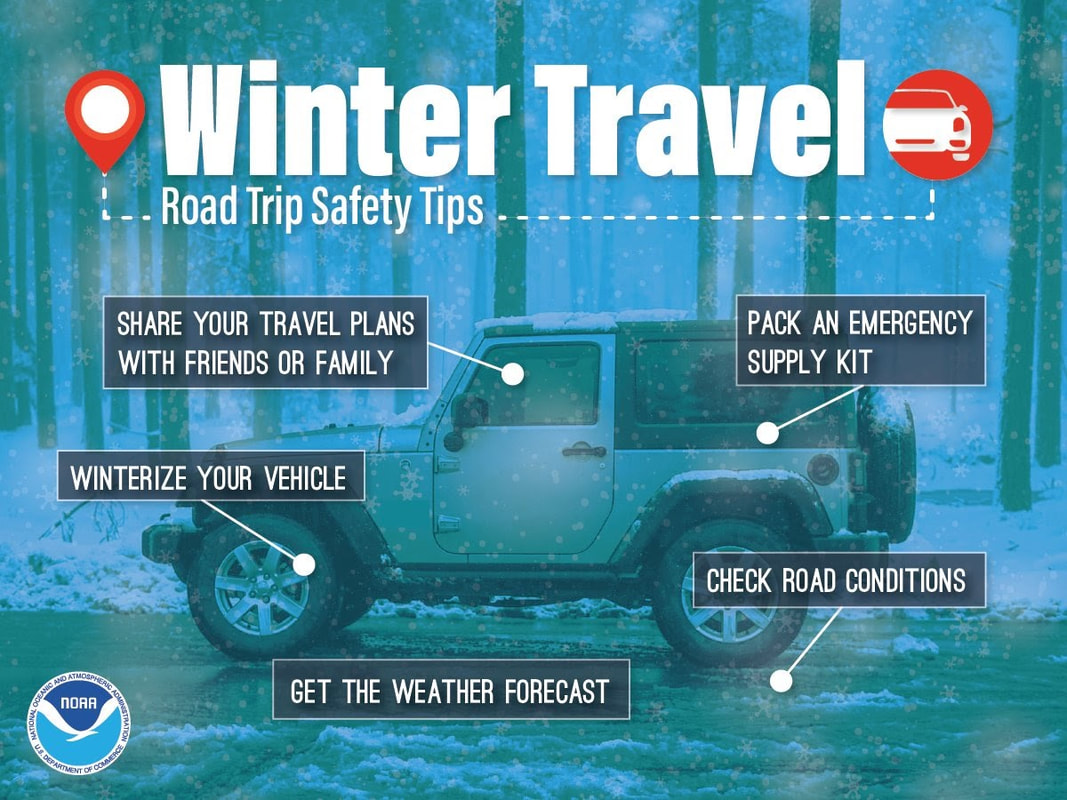 If you’re going to be driving this winter, know how to stay safe. Winterize your vehicle and pack an emergency supply kit. Share your travel plans with friends and family. Before leaving, check road conditions and the weather forecast so you know what to expect. weather.gov/safety/winter Be prepared to receive alerts and stay updated!
For more information, please follow Pine Tree Weather on Facebook and Twitter.
** FUNDING NEEDED FOR 2021 ** Thank you for supporting this community based weather information source that is funded by your financial contributions. Stay updated, stay on alert, and stay safe! - Mike |

Mike Haggett
|