|
First off, welcome to all the new followers! I appreciate your interest to check out what I do. I am 51 years old, a life long Mainer, who has this passion for forecasting weather. I do this on my own mission to learn the artform of it. I work off donations from those who appreciate what I do. My day started at 2 AM for formulate this discussion. I will travel to my day job after this is posted, and work 10 hours there. I am completely independent, stay out of politics, have no agenda and work to be honest with integrity. I don't put up with trolls, or people who just want to give me a hard time or vent frustration. I hold myself accountable and will own my mistakes in significant forecast errors. If you like what I do, wonderful! If you don't, I totally understand, and you can unfollow at any time. Just be respectful in all communications with me is all I ask. If you want to know more about me, check my bio. Check out the website when you have time. There are many things here you may find useful. Now that the pleasantries are out of the way, it's now time to get into it. An ALL snow event for a change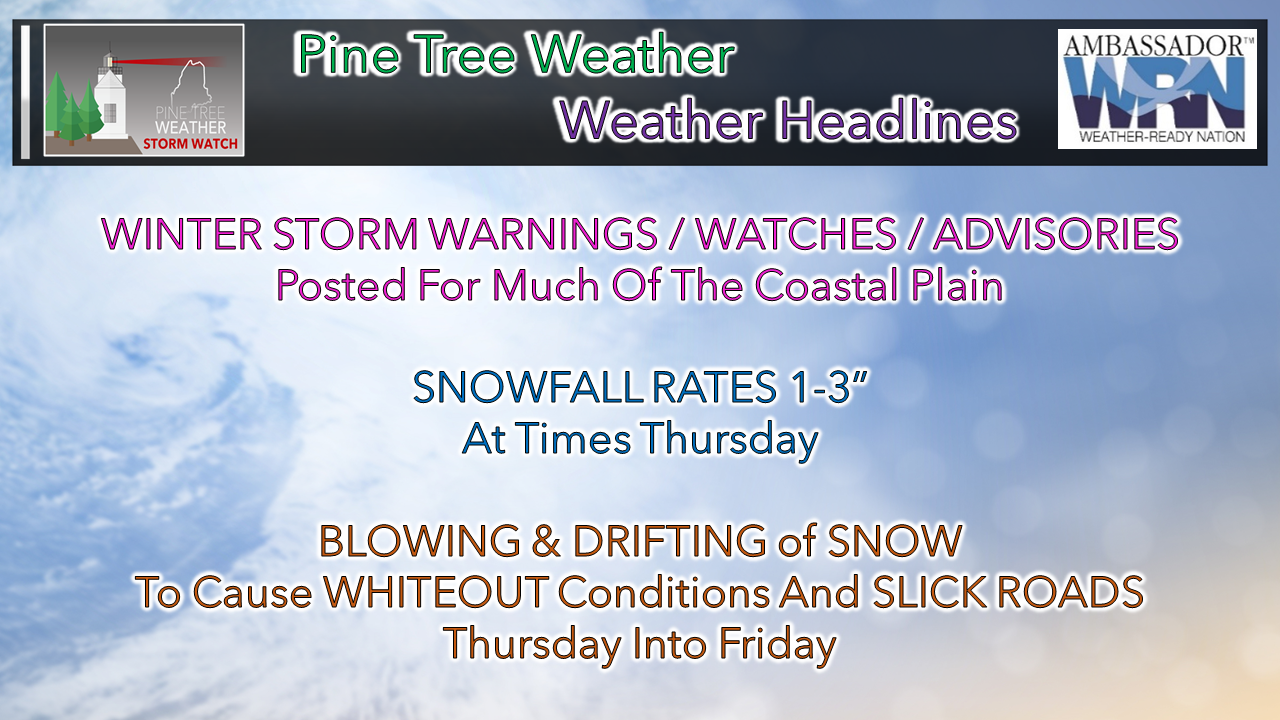 In this day of warmer average temperatures over our winters, a straight all snow event is a rare feature. There is usually some sort of sleet or freezing rain mix, or a coastal front to contend with. Thanks to the arctic blast that came in Tuesday, this storm is set up to be all snow, and fluffy at that. It will come down hard and blow around in the most populated areas of the state. That is the challenge with this one. Well below normal cold for Wednesday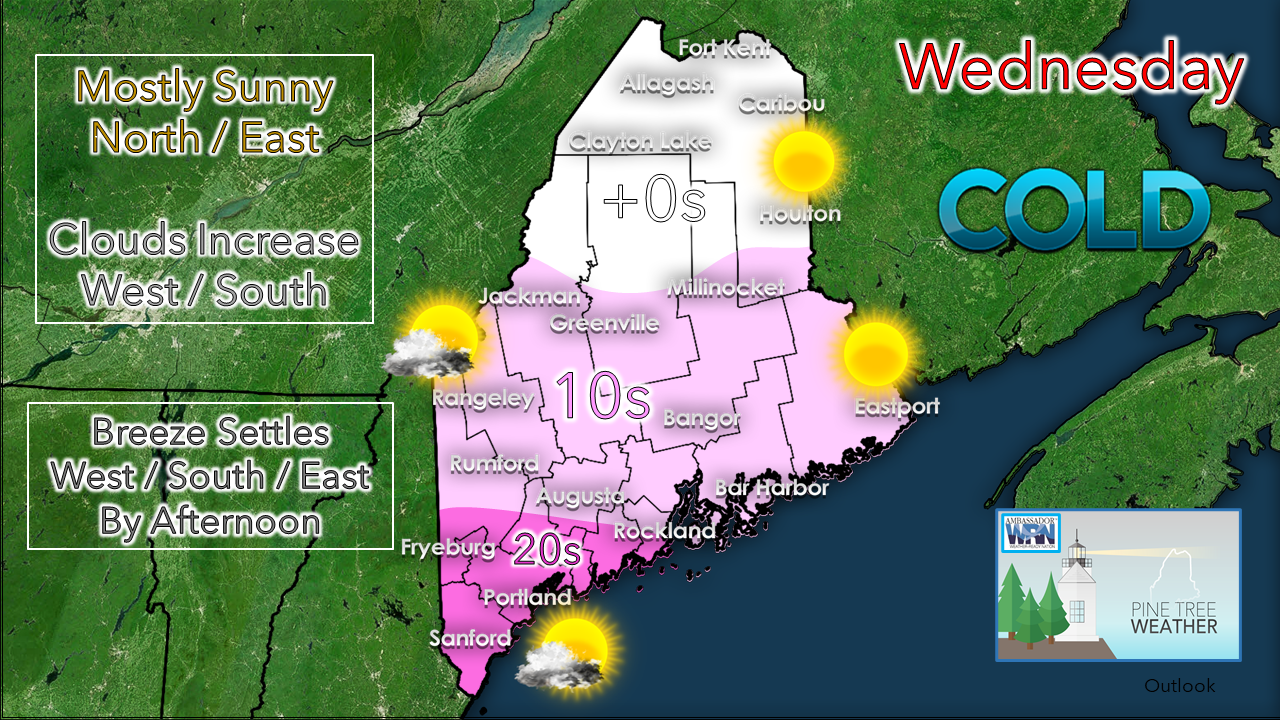 Bitter cold wind chills to start the day, but the wind drops for all but northern areas this afternoon. Northern and eastern areas have the bluebird sky. Clouds will increase over western and southern areas as the day progresses. The high temperatures of the day will run 10-15° below normal. If you can't taste snow with this set up, you may want to recalibrate your taste buds. Timing and velocity of snow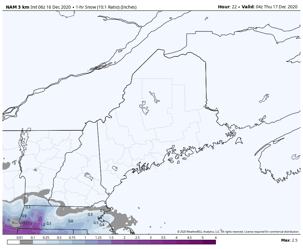 NAM model idea of snowfall rates per hour from 11 PM Wednesday to 7 AM Thursday Snow does not kick into gear until the wee hours of Thursday into the morning commute. By the end of this loop by 7 AM, heavy snow will be falling over southwestern areas. Some areas of York County may have upwards of 6" of snow on the ground by then, with a bit less than that for the Portland area. Please note the snowfall rates at times in the 1-3" per hour range. It is going to DUMP. 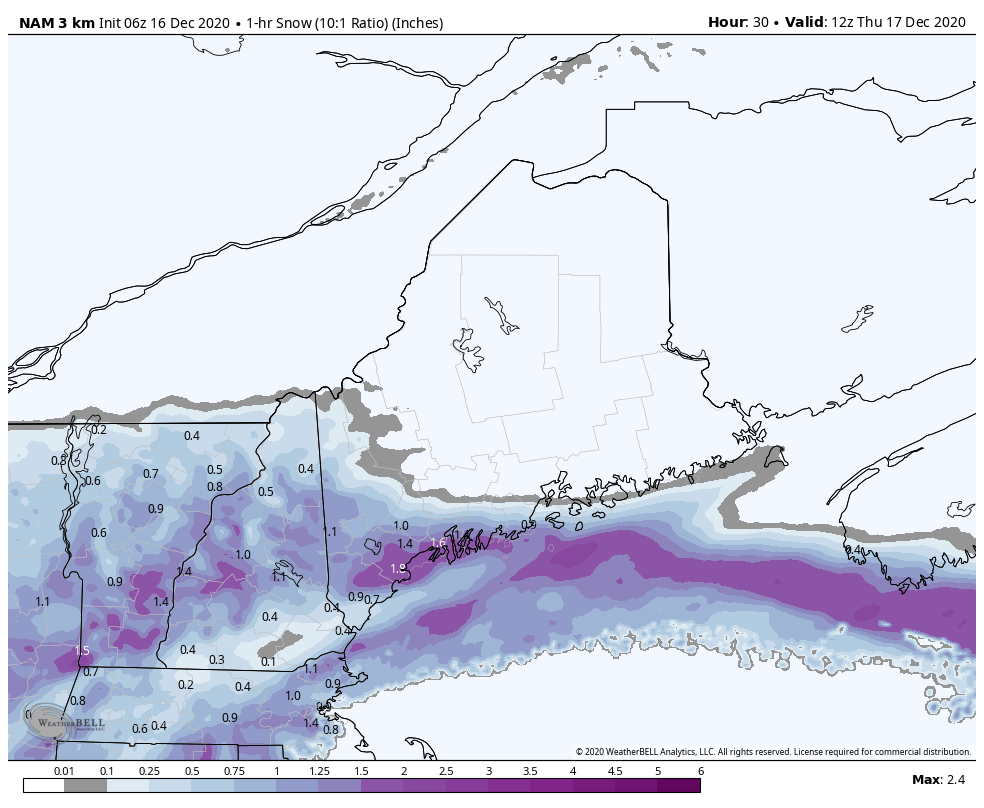 NAM model idea of snowfall rates per hour between 7 AM to 1 PM Thursday As the morning progresses, the snow expands into central and eastern areas, reaching Bangor by around noon. For those in the western mountains over towards Greenville, Millinocket and southern Aroostook, please note the very sharp cut off. 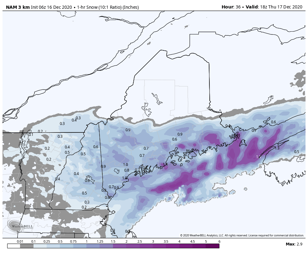 NAM model idea of snowfall rates per hour between 1 PM to 9 PM Thursday Snow tapers from west to east Thursday afternoon, ending in southern and western areas by late afternoon, and by around mid-evening way DownEast. The snow may end, but the blowing and drifting of snow continues. Whiteout conditions a travel concern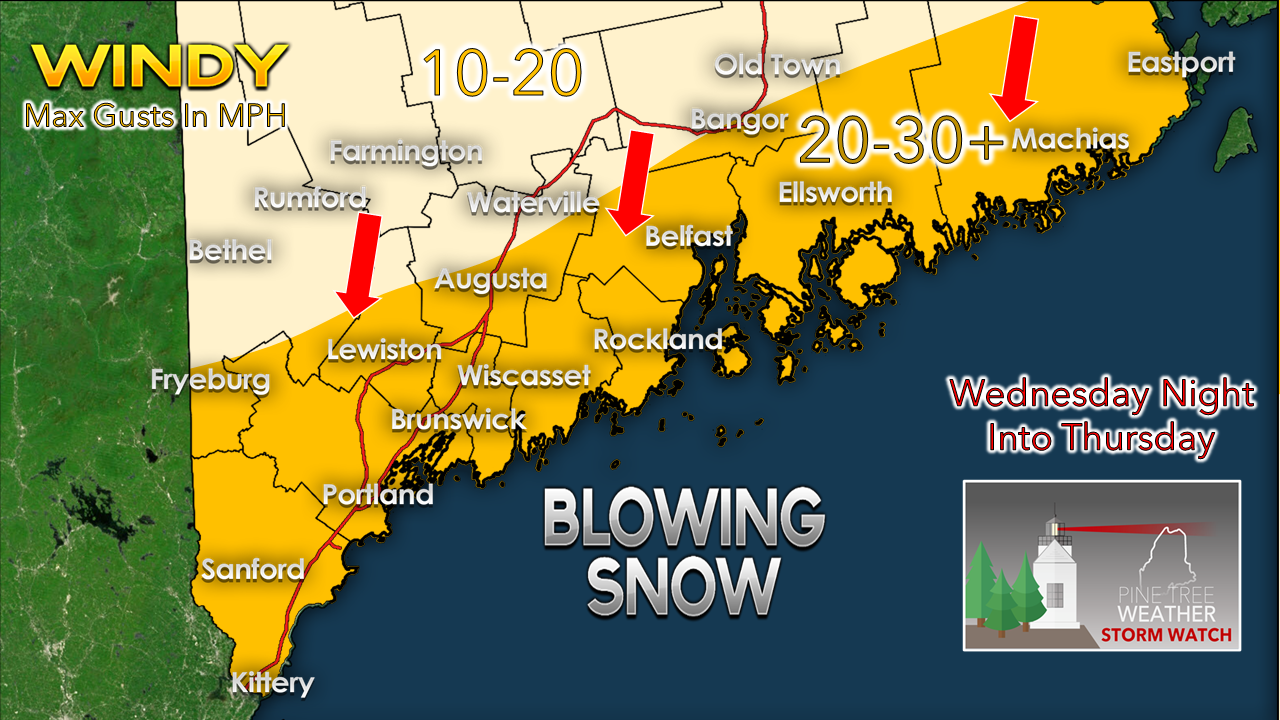 While this is unlikely to classify as a blizzard, it may appear that it is. Anytime there is rapidly accumulating snow and wind at a decent clip, it will be cold slick mess to get around in. This is a high ratio snow event. Snow flake growth in cold temperatures like this essentially makes it falling ice. Roads could become impassable, visibilities could be in feet, and we'll find out who put their snow tires on. While the gustier wind will settle as the snow ends, it appears to remain breezy enough to cause blowing and drifting of snow into Friday, which will continue hazardous driving and frustration for snow removal folks until Friday night / early Saturday. Snowfall amounts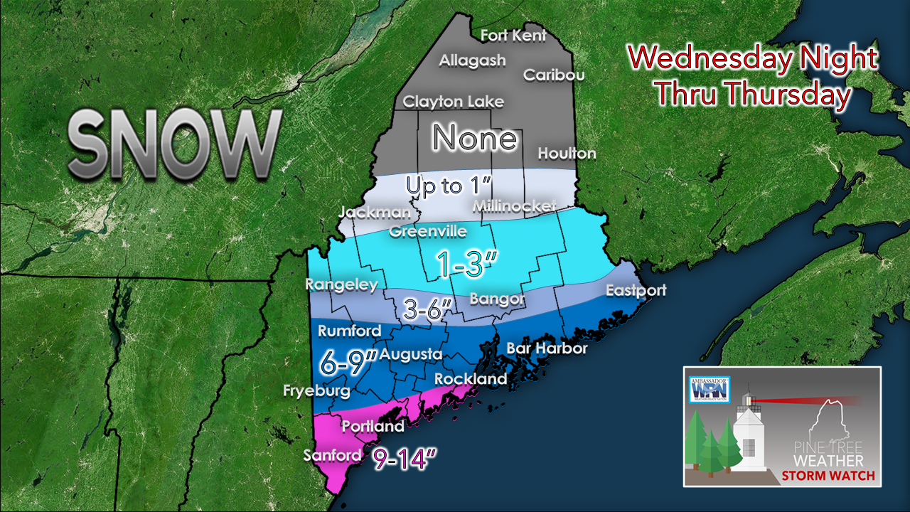 For those that caught my Facebook post Tuesday afternoon, you saw that I increased the forecast amounts. Analyzing data from the overnight model ideas, I am going to stand pat. As I mentioned in the timing section, there is a sharp cut off associated with this. Bust potential is high for the ski hills on up into the Great North Woods and Moosehead. Cold dry air eats up moisture. While I think there is enough of a tropical fire hose attached to this system to make these totals possible this far north, any jog south of the track will cut those totals down. 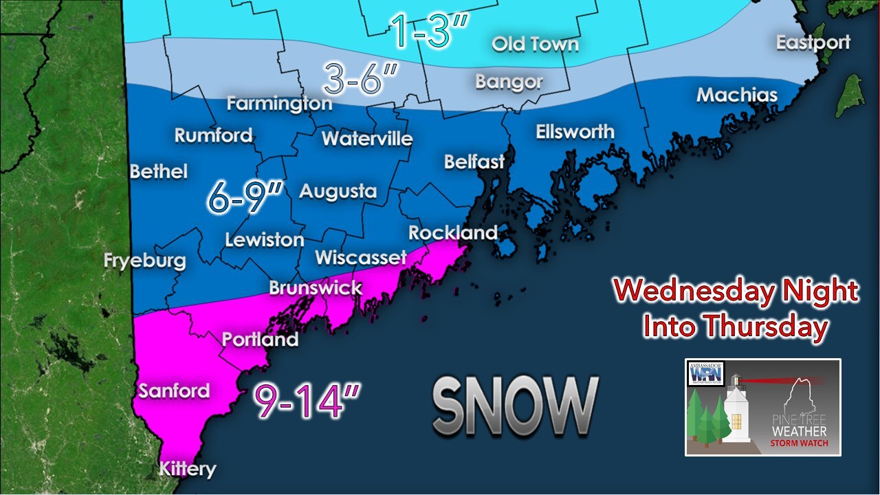 Southwestern areas remain in the jackpot zone. It won't be eastern Pennsylvania where they will need a yard stick to measure this one, but one may need a measuring tape in areas of York County to get an accurate read. NOTE: I will state again that this is a high ratio snow event, roughly in the 15" of snow for 1" of liquid. Some of the ideas I have seen for liquid amounts associated with this go over that. What I am saying here is this is a fairly conservative estimate, and snow amounts could go higher.  Temperature & outlook through TuesdayAfter this storm, the pattern settles down. Snow showers are possible around the region Sunday as a ridge moves in from the southwest. After the Thursday morning low temperature point, the mercury begins to move upward to at or slightly above normal temperatures by Tuesday. 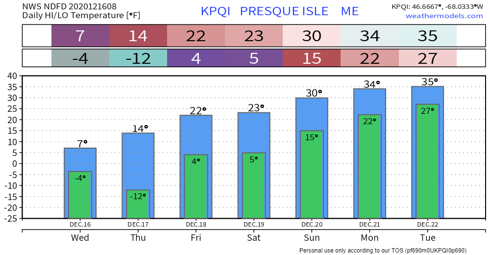 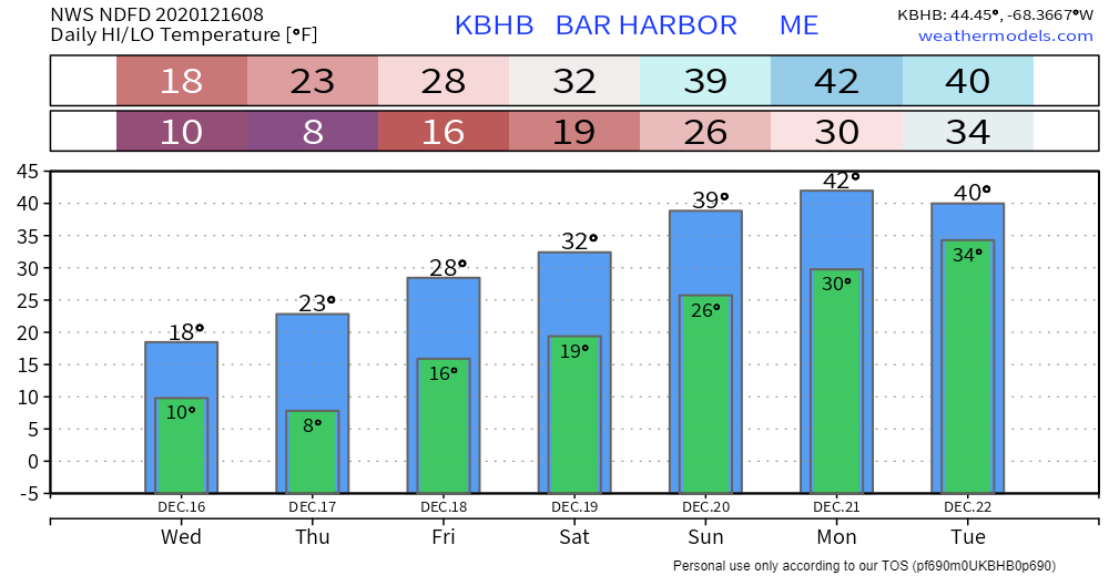 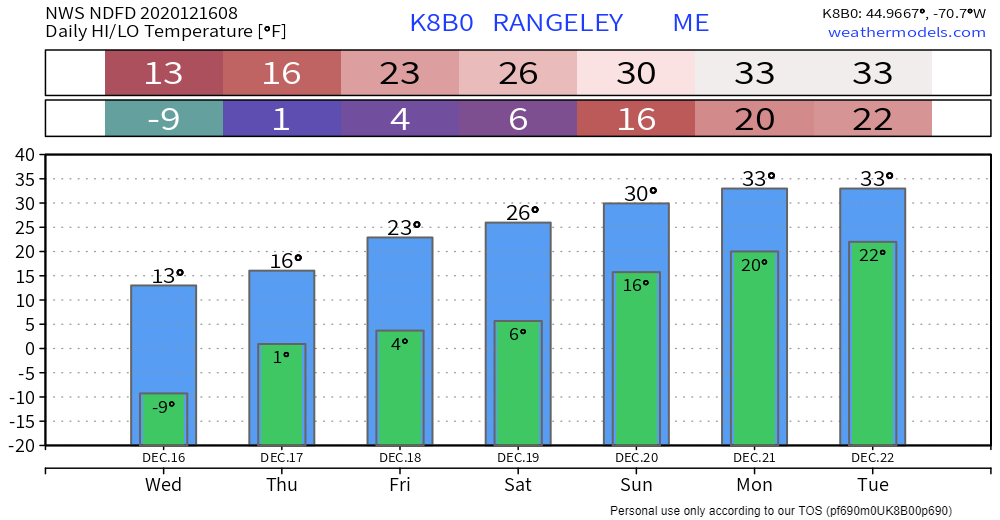 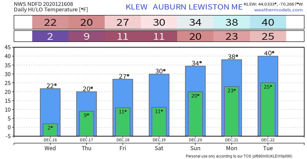 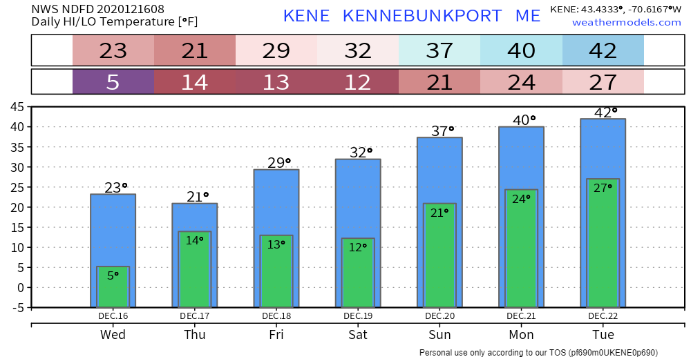 Take it easy on the roads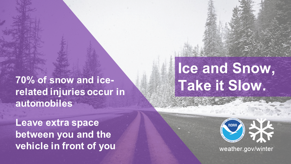 Winter driving can be hazardous. One simple way to keep yourself and everyone on the road safe is to slow down. Remember, “Ice and snow, take it slow”. Learn more at weather.gov/winter Be prepared to receive alerts and stay updated!
For more information, please follow Pine Tree Weather on Facebook and Twitter.
** FUNDING NEEDED FOR 2021 ** Thank you for supporting this community based weather information source that is funded by your financial contributions. Stay updated, stay on alert, and stay safe! - Mike |

Mike Haggett
|