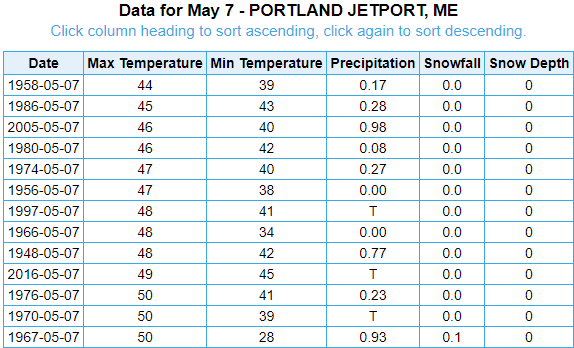
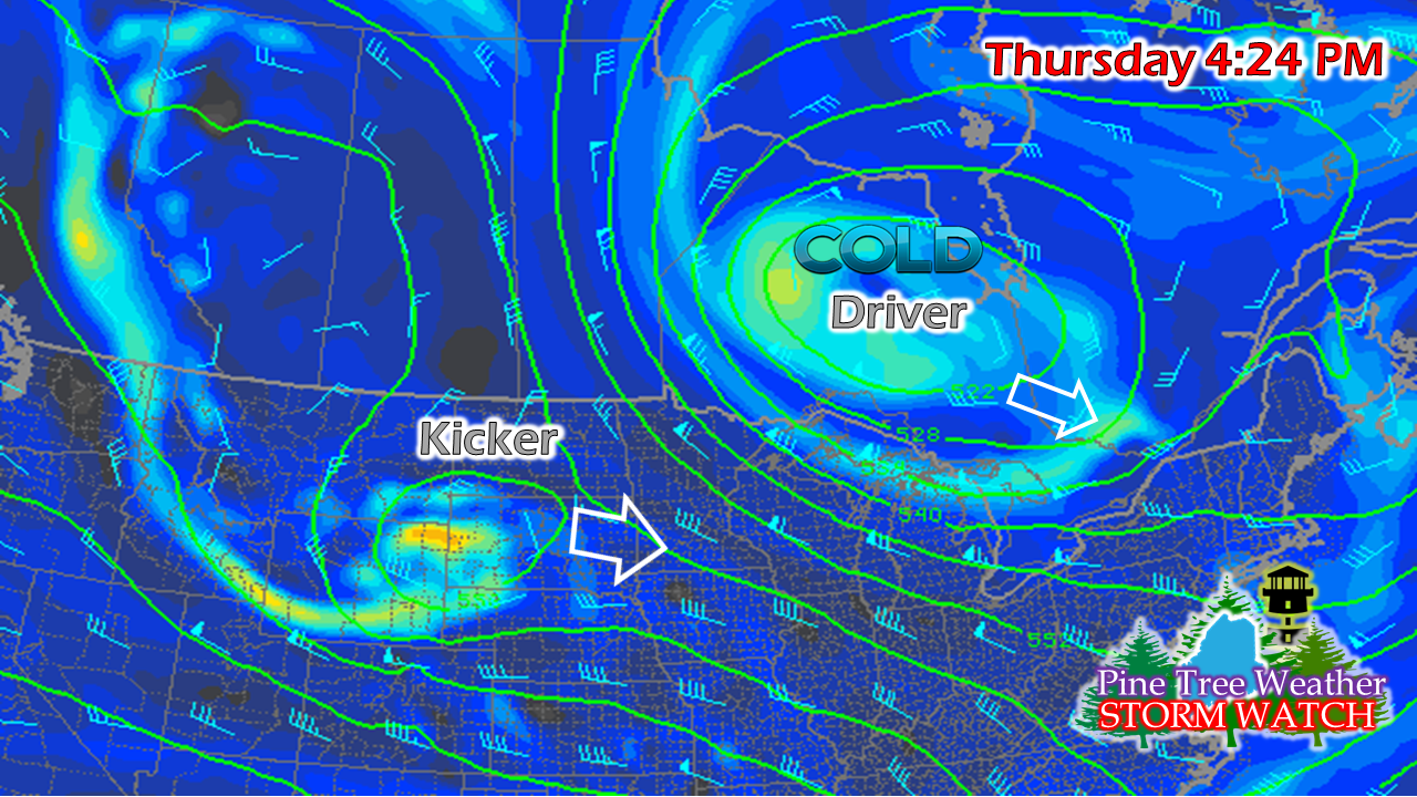
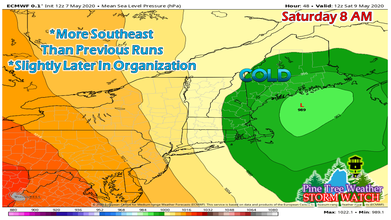
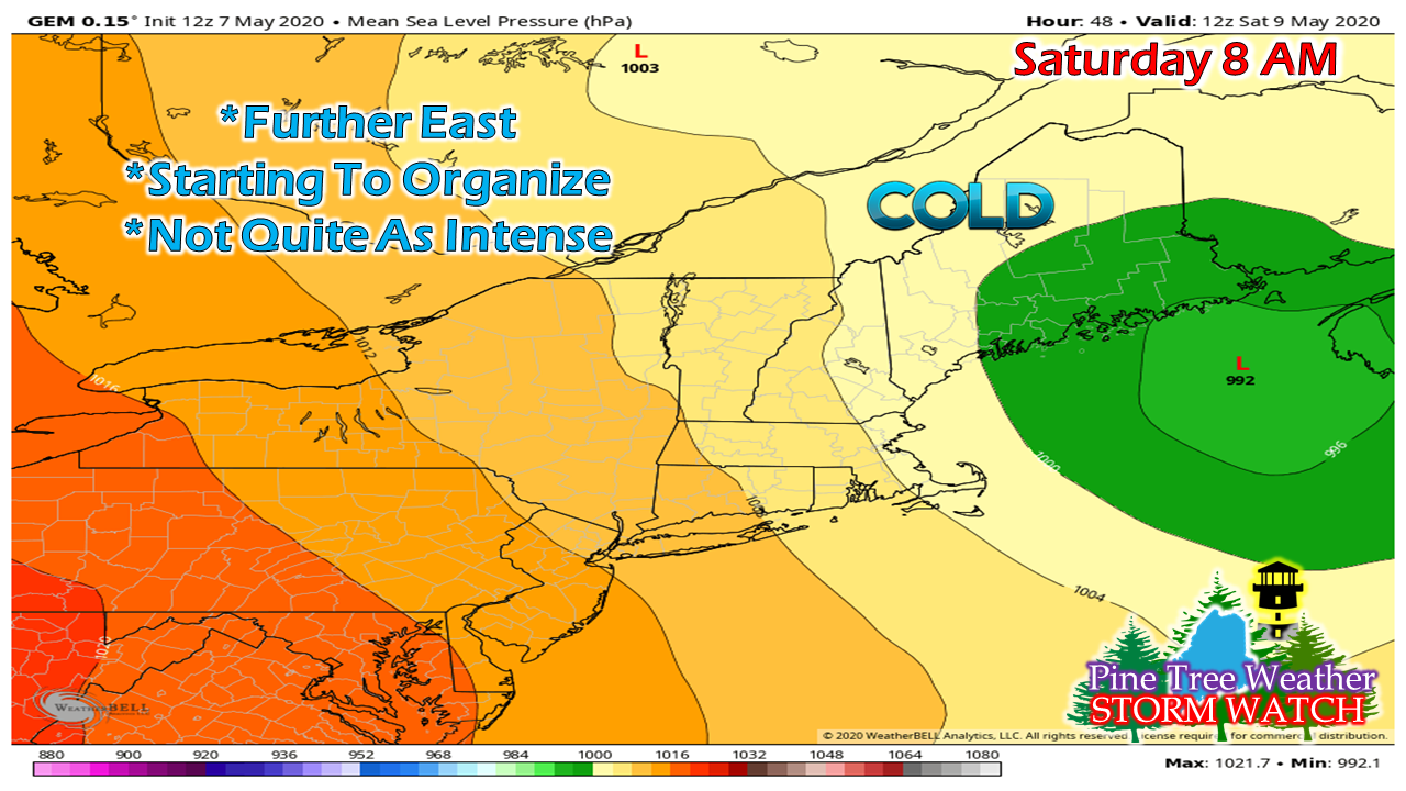
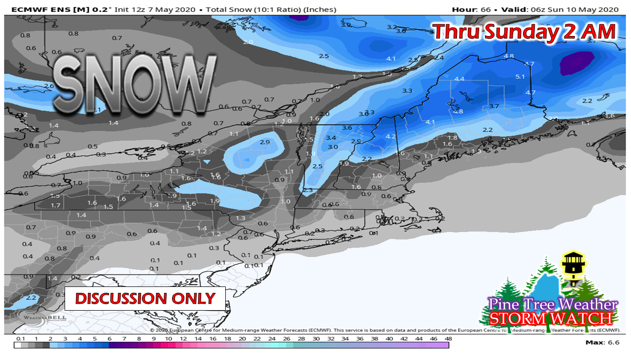
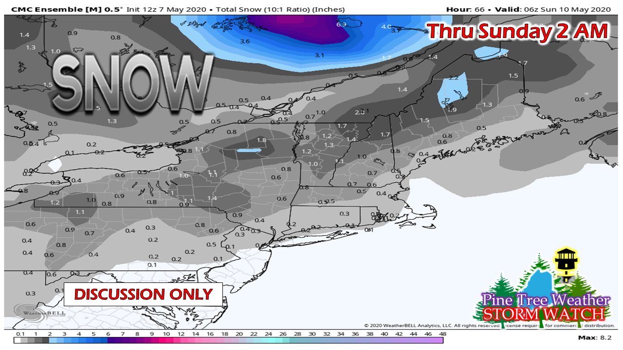
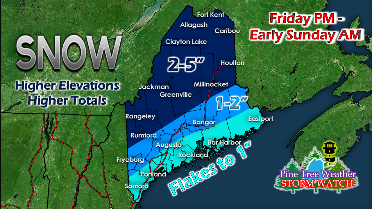
Cold spring, but not many records brokenBefore I get into the storm, I want to briefly discuss climate history. Whether it is co-workers, friends, family or followers, people are telling me "Wow, this a cold spring! What is going on? I don't remember it ever being this cold!" I can appreciate short term memory loss since I am a 50-something and it creeps in for me from time to time. I found this data above to be rather interesting. Using Portland as a data set for this date, one can see since 1940 we've had some cool periods. Thursday's unofficial high temperature at the Portland Jetport reached 60°, which is about normal (61° the 30-year average). We've had some cooler days, with 2016 & 2005 on the chart. With 44° the record low max temperature set in 1958, and one tenth of an inch of snow on this day back in 1967, the cold periods in Maine in May can and do happen. Only one record low has fallen this spring, and that was in Caribou, so that should speak volumes that while it's been on chilly side, it's not totally uncommon. Lots of hype, lots of bust potential, tooI am seeing some media outlets putting out headline like "historic snow storm on the way for the northeast" or "over 45 million people will be below freezing" and I just want to climb through the monitor and strangle the click bait artist who did that. For those with good memory, Memorial Day Weekend 2013 brought 2 feet of snow in the Adirondacks and over a foot in places in Vermont, with a few inches in New Hampshire. I would consider that "historic" since it was almost June. I am sure a few folks were not impressed with that event, as are many of you about this one. Trust your sources, stick to local forecasters for information and don't click or spread the bait. Let's go back to my discussion from two days ago where I talked about the pieces involved and how the two come together will ultimately dictate what happens here. I noticed a shift in guidance overnight into Thursday morning which has me casting some doubt on the strength of the storm, and consequently the outcome. I want to stress the point that higher elevations are likely going to get some accumulating snow out of this, as will northern areas. All areas could get at least flakes. Whether or not you'll be awake to see them (Portland / Fryeburg southwest likely in the wee hours of Saturday) is yet to be seen, but with the cold around, flakes will fly. The track of guidance has shifted further southeast, which was the first eye opener for me. In this scenario, snow would likely be the dominant precipitation type. With the cold locked in overnight and the upper level temperatures likely to set records, that is the potential outcome on the table. Another piece is the storm will be in the early stages of development, which I indicated would be the case in the Tuesday update I linked above. The further east it organizes, the less snow, and consequently less impacts. The European model above has a more organized storm at this point Saturday morning, but it is slightly later than first thought. It's also an outlier at this point as other guidance has different ideas. The Canadian GGEM has the storm further east, later in organization, flatter and not quite as amped up its European counterpart. While looking at this may not appear to be that big of a deal, it definitely does. Looking at the European ensemble idea, this looks very similar to the map of my own I posted here last night. To its credit, it has not varied much. Things to keep in mind when looking at any 10:1 ratio snowfall map. For one not all snow events fall at 10:1 ratio. In fact, it's very rare they do fall at that ratio uniformly. Another factor here is it is not taking into consideration ground temperature at this point. For an example, Bangor is predicted here to get 2.2" of snow, but with ground temps 40°+ it could melt most of it or a leave a light coating on the grass by the time it is over. The Canadian ensemble is painting a much different picture. The later development and organization pretty much kills the output of the storm. I must say this is also an outlier as well, with the least amount of potential snow. This is a long roundabout way to say that I still like this map. Given the uncertainty of the model and ensemble spread, this is fair outcome. The mountains and higher elevations could see 6"+ (3000'+).
Bust potential is high. There could be another shift before the flakes begin to fly. I will update on this and provide more details on timing and impacts on Friday. Stay calm. Pine Tree Weather on. - Mike |
Mike Haggett
|

