
More on the subject of rain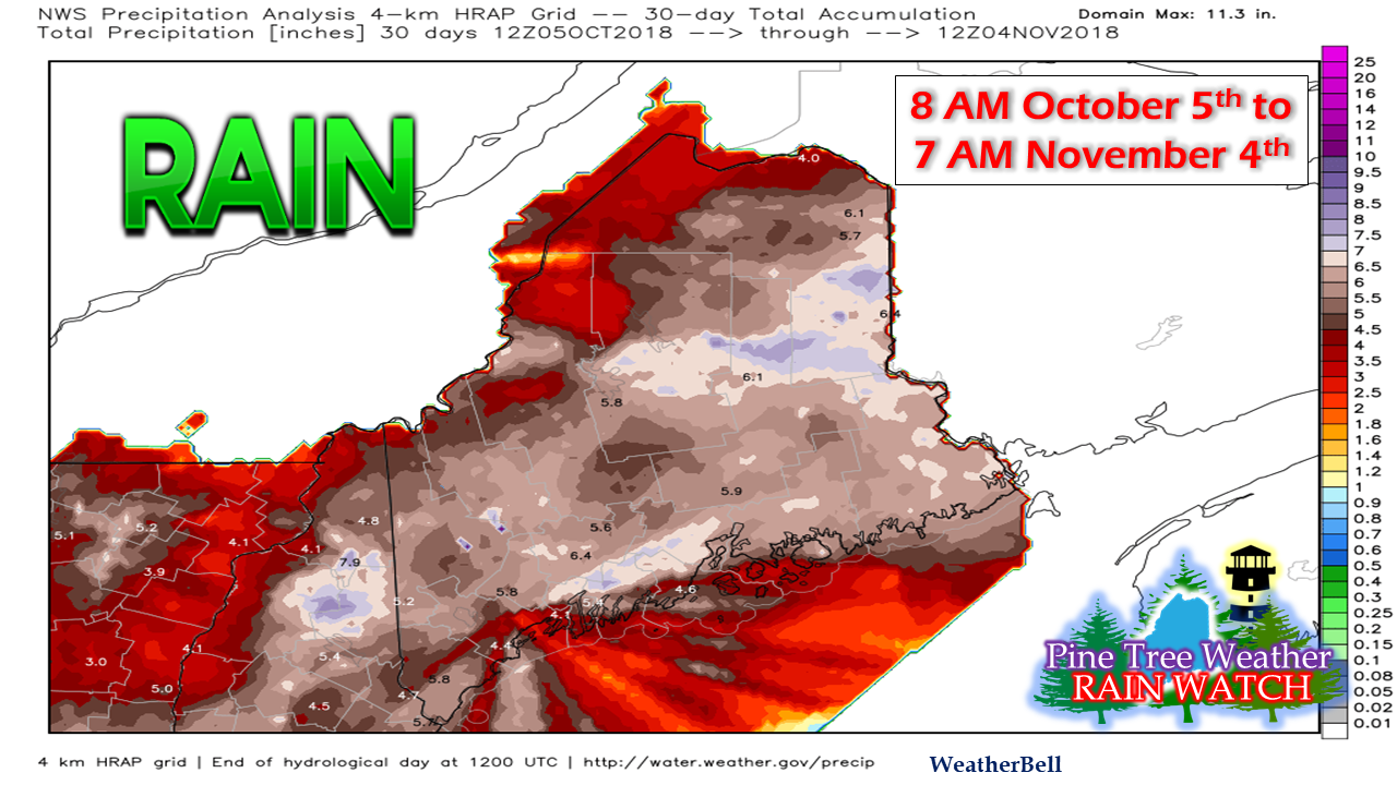 On the heels of the previous post on the rainfall totals, a few more pieces of information to pass along. Even with areas of the state picking up between 4-8" in the past thirty days, there is still has been stealth drought that has been going for a number of years now. Folks who are dependent on groundwater resources are well aware of it. Many of the followers of this website and previously with my years of typing thoughts with Western Maine Weather, it has been a concern for the past half decade for good reason. 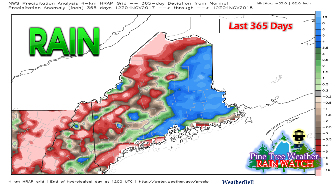 A 365 day view here shows eastern areas of Maine doing quite well, along with parts of the MidCoast and higher terrain. The areas of red and brown aren't doing that well. To no huge surprise, it's those areas where I get messages of concern from. We will need several more soakers to pull even for the year. As outlined in my previous post, the three year departure is far worse. 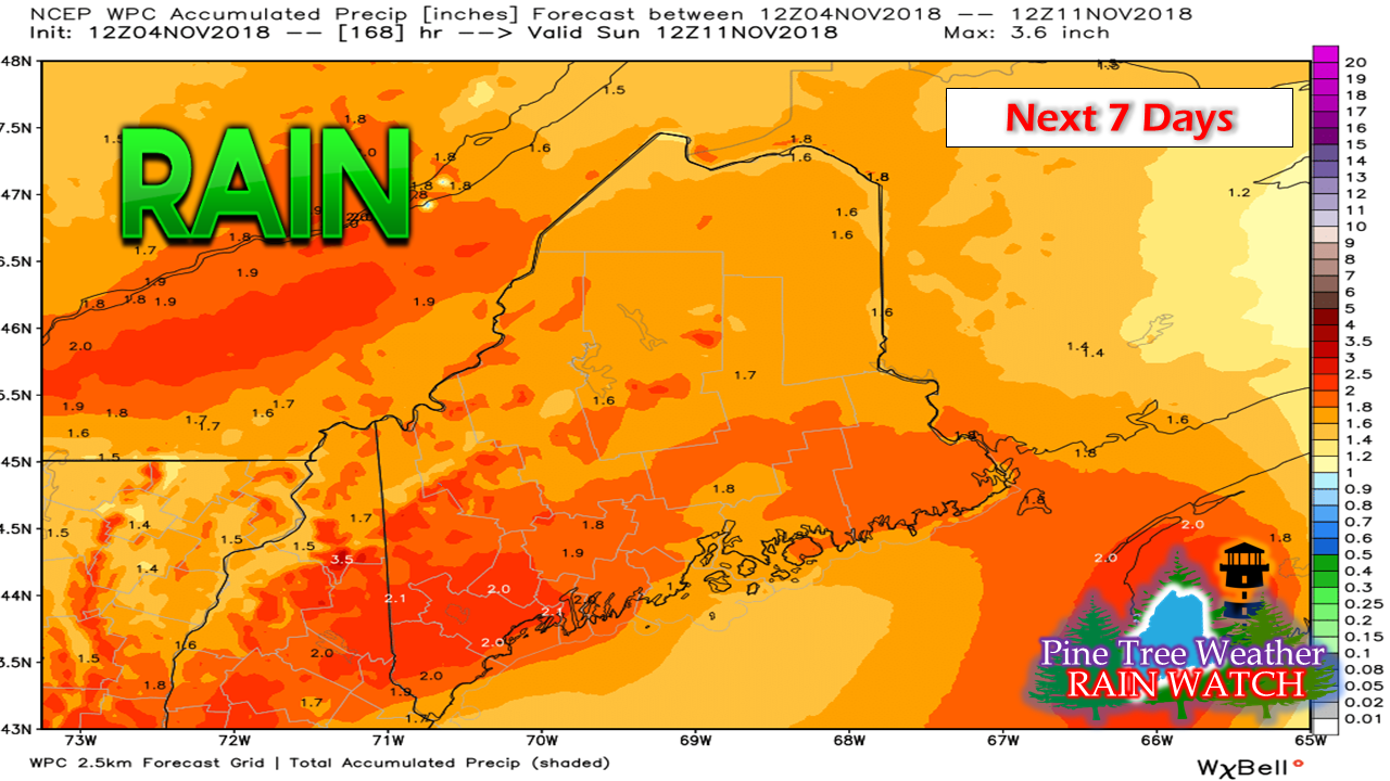 Rain outlook from Weather Prediction Center indicates the potential for 1-2" of rainfall in the next week. The Tuesday affair may bring roughly half of that amount. The storm slated to come in later in the week may produce more than what is being billed, pending on track. 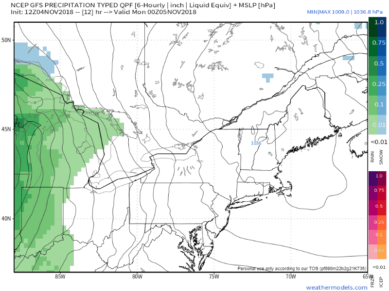 Clouds will be on the increase Monday as a warm front approaches from the southwest. A deepening Colorado low drags a cold front through the region Tuesday into early Wednesday. The folks along the international border with Quebec are likely to see flurries in the higher terrain Wednesday and Thursday. Signs of below normal cold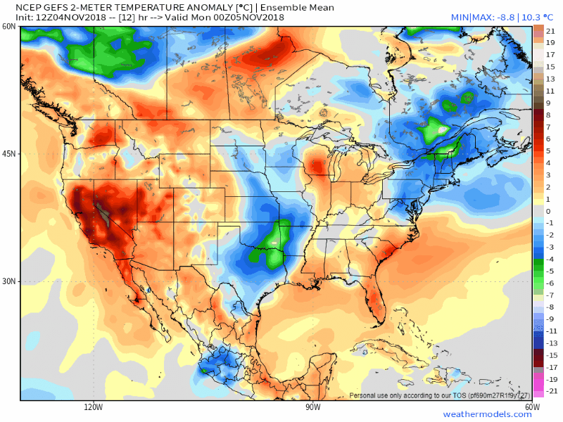 A look at near surface anomalous temperatures (read: above / below seasonal normal) through the work week shows a decent warm up with the storm approaching from the southwest. The region appears on the warm side until we approach Friday when a cool down could begin. Both the GFS & European models are hinting at a future cool down for much of the east coast going into the second full week of November. 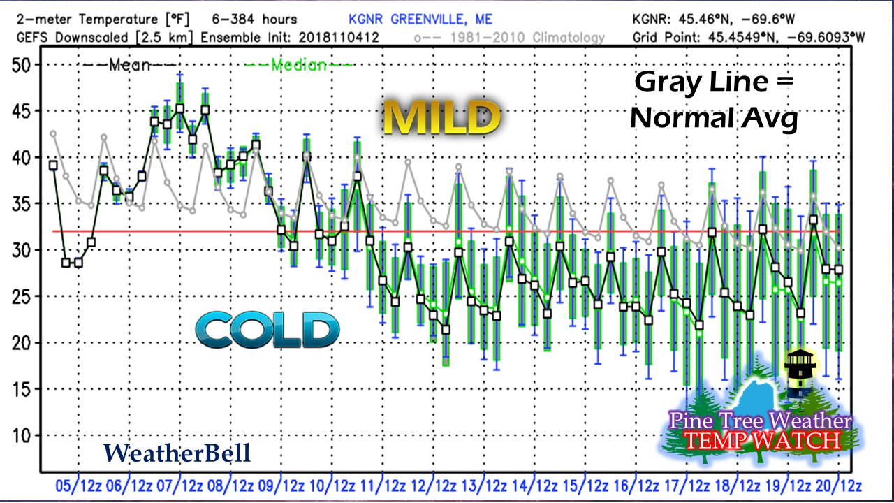 A look at this in grid form through the GEFS ensembles from the 12z (7 AM) run on Sunday for Greenville show the warm up with the mild temperatures early in the work week. After a couple of day of near normal temperatures over next weekend, then the cold is slated to move in. Time will tell if it will feature days that could be below freezing for highs and lows for the day, but if the mercury does make it above 32° it may not go only a handful of degrees above it. This will be good news for ski country and snowmobilers if snow comes along with it and bring a kick start for winter... something the area hasn't seen in few years. Stay tuned... 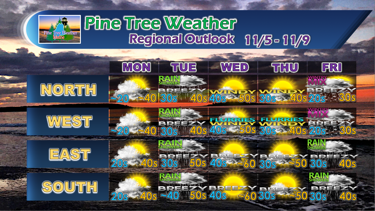 The only thing I did not discuss in the post is wind. We'll get a break on Monday, but it appears to amp up Tuesday, and then teeter on Flying Trash Can level Wednesday and perhaps Thursday. Guidance for now is conflicted on what happens Friday into Saturday on track, strength and precipitation type, but this is my best guesstimate for now.
For the latest official forecasts, bulletins and advisories, please check in with the National Weather Service in Gray for western and southern areas, or Caribou for northern and eastern parts of Maine. For more information from me, please follow the Pine Tree Weather Facebook page and my Twitter feed. Please consider making a donation to keep Pine Tree Weather going through the year ahead. My data cost expense is increasing. The operation is 70% funded and needs your help to get through the winter. Check out the donate page on how to contribute. Always stay weather aware, and thank you for your support! - Mike |

Mike Haggett
|


