
|
As preface, for those that have not yet read my post from this morning please do so. This is an addendum to it. Wind for the coast, heavy snow inland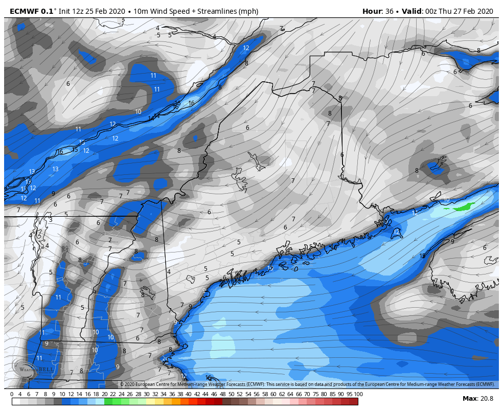 For coastal areas... expect a windy start to the day Thursday. This is shaping up to be a double barreled storm, meaning strong low over the Great Lakes passing along the St. Lawrence River along with low pressure forming over southern New England and intensifying in the Gulf of Maine. This will bring wind gusts in excess of 40 mph for a few hours. This may cause some power outages. The threat continues up the coast through midday before subsiding Tuesday afternoon. For shoreline interests, not only is there wind to deal with, but storm surge. The National Weather Service is estimating a 2-3' storm surge in conjunction with the strongest wind prior to the early afternoon high tide. The good news is tides are not astronomically high as the new moon passed over last weekend. That said, a four to five hour period of splash over and beach erosion is possible. 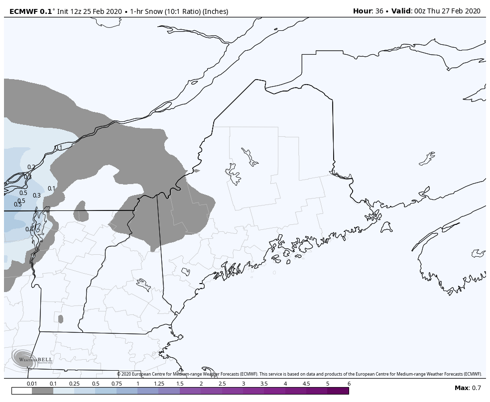 A few things on the snow here. Most importantly, this will be heavy, wet, "heart attack" type snow that falls over much of the state. This will be a very difficult task to move. Add to that, snowfall rates in excess of 1" per hour are possible over the western mountains starting around mid-morning and passes through there by mid-afternoon. Northern areas get in on it around noon and the heavier precipitation ends by late afternoon. Once the wind shifts, cold air comes in. The wet snow will turn to fluffier snow with the change to the northwest. Temperatures will fall and it will freeze everything up. Snow showers are likely to continue in the mountains through Friday until the upper low moves into Atlantic Canada. Ski country could get several bonus inches from that.
Important to note for those who are watching snowfall amounts on models... this is NOT a 10:1 ratio snow event. The range could be 4:1 to 6:1. With the amount of moisture with this system and the track of it, model suggested snowfall ideas are rubbish. You can essentially cut them in half. On that point, the haves and have nots with snow will be fairly steep with this one. Models are suggesting a sharp gradient. A difference of 20 miles could be the difference between nothing and 6 or more inches of snow. Unsurprisingly, it is the foothills in western areas over through interior Washington County that will be in the cross hairs of this. Guidance has trended a bit warmer, which also throws a wrench into the forecast. There will be surprises, and there will some areas that will bust. This is a storm that is typical in spring, and with the pattern the way it is, we may as well call it spring now. I will update on Wednesday. Thanks for your support! - Mike |

Mike Haggett
|


